Since the spring of 2013 I am working on most complex hardware & software solution I have ever designed and built myself. The undertaking is challenging as I am dealing with complete life-cycle of solution from electronic, mechanic and software engineering perspectives. The solution has to offer data transmission over different protocols in secure manner, has to be self-powered with solar panel and survive outdoor conditions of hot summer and harsh winter being placed on the ground and under the water. And what is even more challenging I am doing it mostly alone.
Why bother?
From many discussions with my brother, who is researching professor at one of local universities, I understood the problems of water level monitoring – lack of existing infrastructure and high price of creating one.
While the governmental departments are responsible for such infrastructure, in reality – density and precision of measurements is virtual. What is more irritating, they charge academics for verifying models against data (yes, they do not give raw data itself as it would leak out). Building infrastructure from commercial products would require serious budget, as it does not only level transmitters but also data loggers that collect measurements and send them over the network to central point. The cost of such self-sufficient metering station exceeds easily $2500 excluding assembly and maintenance. And cost multiplies; for research at least dozen of such stations have to be deployed. In era of crisis in Europe, getting research budget is hard, and nearly impossible when competencies overlap with government agencies.
The concept
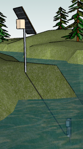
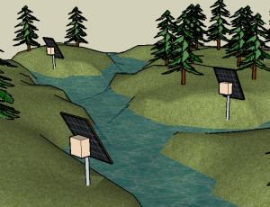
The water level station (WLS) consists of the data logger placed on the ground and the level transmitter, being remote sensor, mounted under water.
Data logger is powered by dedicated solar panel. Next to necessary microelectronics, its case contains rechargeable battery and micro-controlled solar charger to ensure optimal power management. To ensure IP68 waterproof grading, the case minimizes number of connectors: two sealed cable glands – one for solar power input and second for level transmitter link – and air pressure transducer; all other interaction with logger is contactless. Data logger interacts with the world in many ways: it uses MODBUS protocol over RS-485 link to talk to distant water level transmitter, uses GSM to upload measurement data to remote servers using TCP/IP or text messages (SMS) and has local link Bluetooth capabilities.
Level transmitter has waterproof case to hold microelectronics responsible for conversion of water pressure into water level as well as handling MODBUS/RS-485 protocol to communicate with master device. Digital protocol is enabler for distant sensor, even hundreds of meters away, and would add more remote sensors to the same logger in future. WLS may also evolve into environment monitoring station when extended by rainfall or water acidity sensors.
To observe and model hydrological phenomena it is a whole river basin to be monitored. This implies a need to assemble several WLS stations located at least at inlets of rivers. A number of stations working autonomously creates instrumentation layer of overall system.
The control layer, placed on the top of instrumentation, is responsible for centralized data collection, remote configuration and diagnostics. Next to remote control the local access will be also provided: operator with dedicated application on mobile device can access data logger via bluetooth.
Higher layers, like data processing and modeling are out of scope of this discussion and are domain of research of cooperating university scientists.
Development details
Subsequently in several posts I will discuss general problems that may help other hobbyists to solve their issues. Most details of project though will not be disclosed as they are intellectual property and by doing so it will save my time on playing inventors-cloners game. Anyway, if not said otherwise: all rights reserved 😉
See other related articles:
[posts_by_tag tag=”WLS”]


